Montrose Business Times
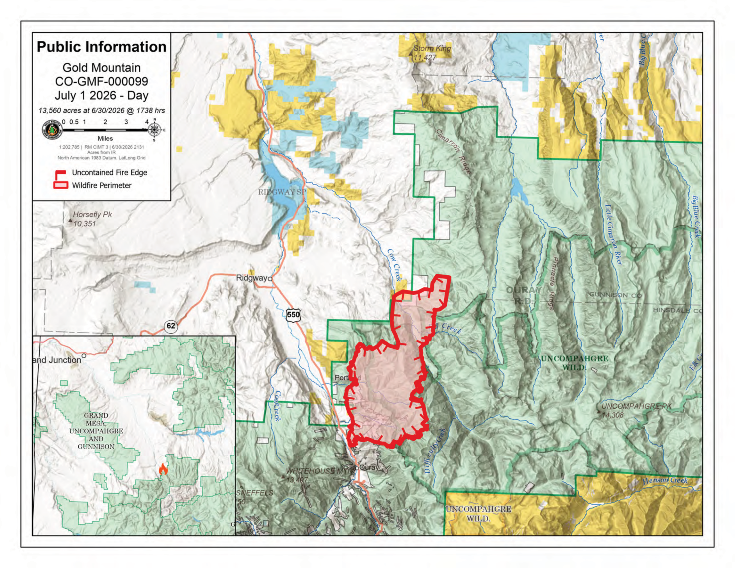
The Gold Mountain Fire northeast of Ouray nearly doubled in size to 14,960 acres Tuesday as extreme fire behavior pushed the wildfire into new terrain under red flag conditions, according to Rocky Mountain Area Complex Incident Management Team 3.
The fire remained 0% contained Wednesday morning. The wildfire, which started June 27 about 2 miles northeast of Ouray, is being fought by 225 personnel. The cause remains under investigation.
Fire officials said strong winds, low humidity and dry fuels fueled significant fire growth Tuesday afternoon. The fire crossed the Cow Creek drainage, made a substantial run up Stealey Mountain and spread northeast toward the Owl Creek Pass area.
Recreationists and dispersed campers were evacuated from the Silverjack and West Fork of the Cimarron drainage as the fire advanced.
Second Chance Animal Shelter in Ridgway as of Wednesday had relocated all its animals.
Spot fires ignited ahead of the main fire into receptive vegetation, creating the potential for additional spread into the West Fork of the Cimarron drainage, according to the incident management team.
Firefighters continued protecting homes, infrastructure and other values at risk Wednesday while searching for opportunities to slow the fire’s spread.
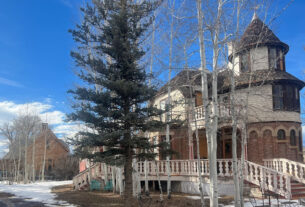
Crews are reinforcing fire lines north of Ouray to prevent the fire from moving south toward the city while also working to protect U.S. Highway 550, transmission lines and structures.
Steep terrain continues to limit direct firefighting efforts along portions of the western edge of the fire, prompting crews to rely on aircraft to identify areas where firefighters can safely construct containment lines.
The eastern side of the fire has expanded enough that incident managers created additional operational divisions to coordinate suppression efforts and assess structure protection needs.
Another Red Flag Warning remained in effect Wednesday. Fire officials said poor overnight humidity recovery is expected to allow the fire to become active earlier in the day than it did Tuesday. Forecast highs were expected to reach between 78 and 82 degrees with relative humidity between 9% and 10% and southwest wind gusts up to 25 mph.
Officials warned moderate to extreme fire behavior is expected throughout the day.
Ouray County officials said Wednesday that air quality continues to be poor, particularly during morning hours before afternoon winds increase.
N95 masks are available through Ouray County Public Health for residents who need them, and county officials reminded the public that Stage 2 fire restrictions remain in effect.
Evacuations remain in effect in portions of Ouray County, and closures continue across parts of the Grand Mesa, Uncompahgre and Gunnison national forests, as well as portions of Bureau of Land Management property affected by the fire. Additional evacuation information is available through the Ouray County Emergency Hotline.
Cottonwood Fire approaches 94,000 acres in Utah
The Cottonwood Fire burning in Utah’s Fishlake National Forest, which was causing smoke in the air in Montrose last week, grew to 93,918 acres Wednesday and was 5% contained, with more than 1,200 personnel assigned to the incident.
Fire crews continued strengthening containment lines, conducting burnout operations and extinguishing hotspots around the fire perimeter.
Officials warned that warm, dry weather and low humidity are expected to continue through the week, with unhealthy air quality possible across portions of the region.
The Cottonwood Fire has been one of several large wildfires contributing to smoke across western Colorado, including Montrose, during the past week.
State Highway 153 remains closed, and evacuation orders and forest closures remain in effect in portions of central Utah.
Utah Gov. Spencer Cox has also issued an emergency order temporarily suspending the state’s usual fireworks laws from July 2-5 because of extreme wildfire conditions.
Elsewhere, firefighters continued battling several other large wildfires across Colorado and Utah.
The Snyder Fire in Mesa and Grand counties near the Utah border had burned 30,209 acres and was 10% contained Wednesday. Evacuation warnings remain in place for portions of the Glade Park and Loma areas, and closures continue in the McInnis Canyons National Conservation Area.
In southeastern Utah, the Babylon Fire had grown to 53,871 acres and remained 0% contained. The fire is burning within the Manti-La Sal National Forest near Bears Ears National Monument, prompting closures in portions of the Needles District of Canyonlands National Park.
The Ferris Fire, which merged with the Doe Canyon Fire in Montezuma and Dolores counties, had burned 21,495 acres and remained 0% contained. Level 3 evacuation orders remain in effect for several rural communities near McPhee Dam and Lone Mesa State Park as firefighters continue protecting homes and ranches.