Montrose Business Times
The Gold Mountain Fire has grown to 31,420 acres, but cooler, more humid weather and light showers helped keep fire activity relatively quiet Tuesday as firefighters increased containment to 8%.
The fire, burning about 2 miles northeast of Ouray, had earlier this week prompted evacuation orders and notices across portions of Ouray, Montrose and Gunnison counties since it started June 27. A total of 976 personnel are now assigned to the fire, up from 824 on Monday.
Its cause remains undetermined.
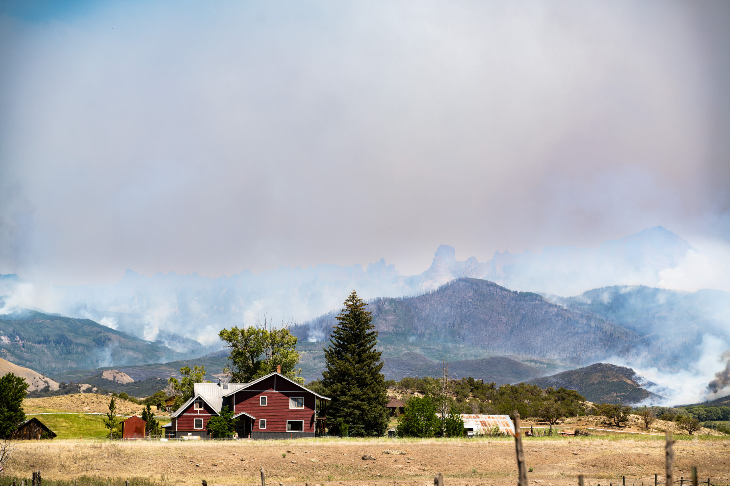
The change in fire behavior comes after days of heavy smoke across Montrose and much of western Colorado.
Resources are available for those affected by the fires across Colorado.
Smoke from both the Gold Mountain Fire and the Cottonwood Fire in Utah blanketed Montrose on Monday, when some local air quality sensors reported Air Quality Index readings in the 220s by about 10:30 a.m. An AQI between 201 and 300 is considered very unhealthy.
Conditions have improved considerably since then. Montrose’s air quality forecast for Wednesday called for an AQI of 70, within the moderate category.
The forecast calls for generally moderate air quality through the weekend, with an AQI of 65 Thursday, 67 Friday, 58 Saturday and 73 Sunday. The forecast rises to 82 Monday and 80 Tuesday, still within the moderate category.
Smoke conditions can change rapidly, however, depending on fire activity and wind direction.
Higher humidity, cloud cover and light showers helped limit the Gold Mountain Fire’s spread Tuesday. Rainfall totals ranged from about 0.05 to 0.10 inches across the fire area — not enough to qualify as a wetting rain — but fire behavior was largely limited to creeping, smoldering and isolated torching of trees and heavier fuels.
Thunderstorms produced gusty and erratic winds of up to 20 mph, but the winds were significantly weaker than those experienced Monday and did not create control problems.
Firefighters spent Tuesday securing and strengthening containment lines following firing operations Monday. Crews completed firing operations along the northwestern edge of the fire and continued patrolling, mopping up and securing those lines.
Infrared mapping also showed very little remaining heat along the U.S. Highway 550 corridor, where minimal fire growth is expected.
The quieter day marked a change from the fire’s rapid growth over the previous week.
The Gold Mountain Fire started at 5:33 p.m. June 27 and had grown to 18,005 acres by July 2, when the Montrose County Sheriff’s Office issued a pre-evacuation notice for Zone 34.
That zone includes properties south of the intersection of P77 Road and Cimarron Road, as well as properties along P77 Road extending one mile north of the intersection.
At the time, the fire was 0% contained and burning under critically dry conditions, with warm temperatures and strong southwest winds pushing it primarily north and northeast through the Cow Creek and Owl Creek drainages. The fire crossed Owl Creek Pass Road as crews worked to reinforce lines along the Highway 550 corridor and Cutler Creek Road.
By Monday, the fire had reached 27,698 acres and crossed into southwestern Gunnison County, prompting a mandatory evacuation of Zone 32.
That zone includes the Bear Claw, Silver Jack, Eagle’s Rest and Little Bighorn subdivisions in an area generally south of Storm King and east of Cimarron Ridge to County Road 864A in the Cimarron Valley and the U.S. Forest Service boundary.
Gunnison County also placed Zone 33 under a voluntary evacuation notice. That area includes properties along Johnson Park Road and Little Cimarron Road.
Montrose County, meanwhile, upgraded Zone 34 from pre-evacuation status to a voluntary evacuation notice.
The spread into Gunnison County represented a significant expansion of the fire, but improving conditions Sunday and Monday also gave firefighters opportunities to begin building containment.
Lighter winds Sunday allowed crews to begin strategic firing operations between Baldy Peak and County Road 12. Those operations were intended to strengthen indirect containment lines and reduce the threat to communities and other areas at risk, including Ouray, Ridgway, the Highway 550 corridor and communities north and northwest of the fire.
By Monday morning, firefighters had established the first reported containment on the fire’s southwest perimeter.
Crews continued firing operations Monday and have since completed those operations along the fire’s northwestern edge. Firefighters are now focused on securing the lines and ensuring the fire remains within established containment boundaries.
Operations also remain focused on strengthening containment north of Ouray. Crews are constructing indirect confinement lines north of the fire to reduce the potential for westward spread.
Firefighters are improving dozer and hand lines near private properties from Cold Creek to Lou Creek in preparation for possible future strategic firing operations if needed.
Structure protection groups continue assessing and preparing homes, ranches and other property by improving defensible space and identifying mitigation needs. Point protection efforts remain a priority near Silver Jack Reservoir, High Mesa, Johnson Park and surrounding communities.
Fire crews are working to keep the fire north of Ouray, east of Highway 550 and Ridgway, and south of Silver Jack Reservoir.
Strategic firing operations and continued fireline construction have reduced the threat to Ouray, according to fire officials. Stronger containment lines have also allowed evacuation officials to reduce some mandatory evacuation areas directly north of Ouray to voluntary status.
Additional repopulation decisions will be evaluated as firefighters continue securing containment lines.
The fire has already tested communities across a large portion of the northern San Juan Mountains and Cimarron Valley.
As the fire pushed north last week, the Cimarron State Wildlife Area was closed to public access. Portions of the Grand Mesa, Uncompahgre and Gunnison national forests and Bureau of Land Management lands also remain under emergency closure orders.
Additional isolated showers and thunderstorms are possible Wednesday, primarily over higher ridges. There is a slight chance of lightning but again only a low chance of enough rainfall to produce a wetting rain.
Fire behavior is expected to remain low to moderate Wednesday, but officials cautioned that the fire continues to burn in heavy timber, mixed conifer stands and drainages where heat remains.
Warmer and drier weather expected later this week could increase fire activity as temperatures rise and humidity falls. Fire managers expect future spread to be driven primarily by terrain, with activity focused on slopes and drainages.
The rapid growth of the fire over the past week underscores how quickly conditions can change.
The fire grew from 18,005 acres and no containment July 2 to 27,698 acres and 3% containment by Monday. It has now reached 31,420 acres, while containment has increased to 8%.
For evacuation and road closure information, residents can contact the Ouray County Evacuation Hotline at 970-626-5484. The Gold Mountain Fire information line is 970-355-3286 and is staffed from 8 a.m. to 8 p.m.